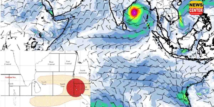
The Department of Meteorology states that the deep depression over the Bay of Bengal, located to the southeast of Sri Lanka, was positioned about 200 kilometers southeast of Batticaloa around 4:00 a.m. today (09).
The department further notes that the system is continuing to intensify and move northwestward, and it is highly likely to cross the Sri Lankan coastline between Pottuvil and Trincomalee this evening.
Cloudy skies are expected over most parts of the island. Intermittent showers or thundershowers may occur in the Northern, North-Central, Eastern, Uva, Central, and North-Western Provinces.
Showers or thundershowers may also occur at several places in the remaining areas during the evening or night.
Heavy rainfall exceeding 100 mm may occur at some places in the Northern and North-Central Provinces, as well as in the Matale, Trincomalee, and Puttalam districts. Fairly heavy rainfall of about 50–75 mm may occur at some places in the Kandy, Nuwara Eliya, and Batticaloa districts.
Strong winds of 50–60 km/h, with gusts up to 70 km/h, may occur at times in the eastern slopes of the Central Hills, as well as in the Northern, North-Central, North-Western, Central, Uva, and Eastern Provinces, and in the Gampaha and Colombo districts.
The public is kindly requested to take necessary precautions to minimize damage caused by temporary strong winds and lightning associated with thundershowers.


