
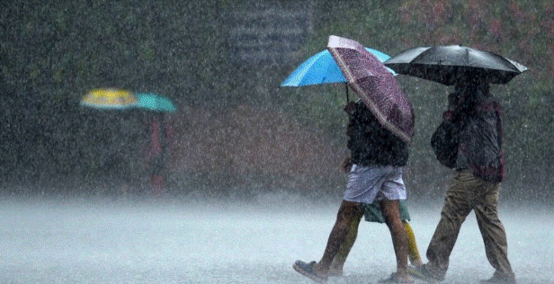
Showery and windy conditions are expected to worsen across most parts of the island following a depression in the Southwest Bay of Bengal, according to the Meteorology Department.
They said the depression over the southwest Bay of Bengal is located 370 km to the northeast of Trincomalee, and it is very likely to cross Sri Lanka during the next 48 hours.
There could be showers in the northern, eastern, north-central and north-western provinces.
Hence, heavy showers exceeding 100 mm could be expected in some places.
Showers or thundershowers was also forecast elsewhere during the afternoon or night.
Strong winds between 40-50 km/h expected to blow at times over the Northern, Eastern, North-Western, Western, and Sabaragamuwa provinces, as well as in the Galle and Matara districts.
The general public are advised to take adequate precautionary measures to safeguard themselves from damages may have been caused by gusty winds and lightning during thundershowers
WEATHER FORECAST FOR 25 DECEMBER 2022
Issued at 05.30 a.m. on 25 December 2022
The depression over Southwest Bay of Bengal has entered through the east coast of Sri Lanka and it is moving across the country.
Showers or thunder showers will occur at times over most parts of the country. Very heavy showers above 150 mm can be expected at some places in Eastern, Uva, central, Sabaragamuwa, Western, Southern and Northwestern provinces and in Polonnaruwa district. Fairly heavy showers above 75mm can be expected at some places elsewhere.
Strong gusty winds of about (40-50) kmph can be expected at times over country.
General public is kindly requested to take adequate precautions to minimize damages caused by temporary localized strong winds and lightning during thundershowers.